
Pretender-Kadarkoppa Lift Irrigation Scheme
Construction of Kadarakoppa Lift Irrigation Scheme from Ghataprabha River Near Udagatti Village for Providing Irrigation Facility Suffering Atchkat of Ghataprabha Right Bank Canal from Km.139.00 To Km 145.00 Km in Mudol and Badami Taluks, Bagalkot District.
Client:
M/s Minor Irrigation and Ground Water Development Department
Project Description:
The Ghataprabha Project envisages the construction of a storage dam at Hidkal Dam across the Ghataprabha river with two main canals on the two banks of the Ghataprabha river. The Ghataprabha left bank canal takes off from Dhupdal weir situated 20 Km downstream of Hidkal dam and ultimately supplies water for irrigation of 1.62 lakh hectares of land in Belgaum district and Bagalkot Districts. The Ghataprabha right bank canal takes off from Hidkal Dam itself and provides irrigation for 1.56 lakh hectares, in the districts of Belgaum and Bagalkot. The project is being executed in three stages.
Stage-I and Stage-II consist of the construction of the Ghataprabha left bank canal as an unlined canal and the partial construction of Hidkal Dam. The irrigable area envisaged was 1.21 lakh hectares. Stage-III includes the following:
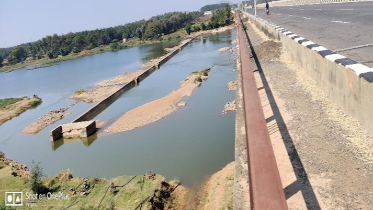
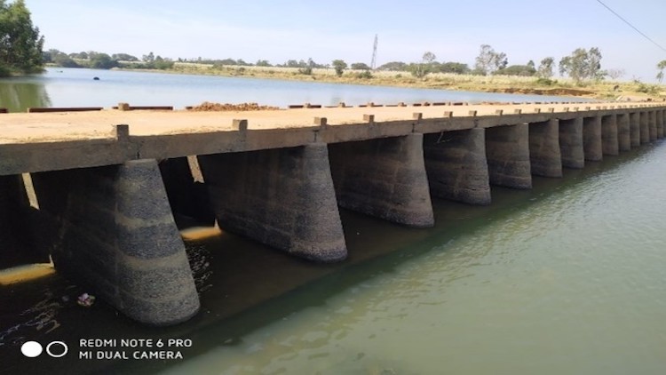
- Construction of the Ghataprabha right bank canal
- Construction of the Hidkal Dam (i.e., raising the Dam to its final height to store 1.38 TMC.
- The lining of Ghataprabha left bank canal including branches and distributaries down to 0.56 cumec.
The Ghataprabha Right bank canal km 130.0 onwards is not receiving sufficient water since it is constructed. This is mainly because of the following reasons:
- The water let out in the GRBC canal is 2000 cusecs instead of 2100 cusecs at the head. This is mainly because the canal is taking only 2000 cusecs.
- Due to practicing of cash crops in the head reaches, the water is being utilized more than the planned utilization. Due to the above reasons, there are about 8750.0 hectares of command area is deprived of irrigation facilities.
The above suffering command mainly falls in Badami, Mudhol and Bagalkot taluks of Bagalkot District. There is a long pending representation from farmers of the area and elected representatives for providing the alternate source for feeding the existing GRBC canal and distributary network beyond 135.0 Km particularly to provide irrigation to the suffering command of Palkimani distributary,Shardal distributary and Hanamaneri distributary covering an ICA of 8750.00 Ha. Based on the representations Hon’ble Minister for water resources has directed KNNL to submit a feasibility report for providing an alternate source to cover suffering command area.
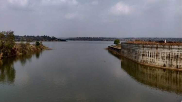
Water can be lifted from the Ghataprabha river i.e., backwater of Almatti reservoir. It is proposed to lift water from this point and deliver it to GRBC. The water lifted from this point is proposed to irrigate 8750.00 Ha of ICA i.e., area covered by Palkimani distributary,Shardal distributary and Hanamaneri distributary.
It is proposed to prepare a Detailed Project Report is prepared for the Construction of Kadarakoppa Lift Irrigation Scheme from Ghataprabha River near Udagatti village to Ch: 140+520 of existing Ghataprabha Right Bank Canal in Bagalkot and Badami taluk, Bagalkot District for covering suffering command of Palkimani distributary,Shardal distributary and Hanamaneri distributary covering an ICA of 8750.000 Ha. The delivery point will be Ch: 140+520 of GRBC.