Consultancy services for detailed investigation, survey, preparation of designs, drawings, estimates, Detailed Project Report and DTP for Construction Bridge-Cum Barrage in Selected reaches of Varada and Dandavathi River in Soraba taluk, Shivamogga District. (Indent No. 33489)
Client:
M/s Karnataka Neeravari Nigam Ltd
Project Description:
Shivamogga district is a part of the malnad region of Karnataka and is also known as the “Gateway to Malnad” or “Malae naada Hebbagilu”. The district is landlocked and bounded by districts of Haveri, Davangere, Chikkamagaluru, Udupi and Uttara Kannada. The district lies between 13°55’20” North latitude and 75°34’14.73″ East longitude in south Karnataka at mean altitude of 640 mtrs above sea level, Total geographical area of the district is 8477 Sq Kms spread across 7 talukas -Thirthahalli 1254 Sq kms), Bhadravathi (690 Sq kms), Shivamogga (1113 Sq kms ), Shikaripura(909 Sqkms ), Soraba (1148Sq kms ), Sagara (1940 Sq kms), Hosanagara ( 1423 Sq kms) -which is 3.1% of the state geographical area. Of which 6641 Sq km falls under Western Ghat region (Sagar1940 sq km, Hosanagara 1423 sq km, Thirthahalli 1254 sq km, Shikaripura 909 sq kms, Shivamogga 1113 sq kms. The total average rainfall of 7 talukus is -2237.00 mm. Shikaripura and Shivamogga taluks comes under Southern transition zone.
The important rivers that flow through the Shivamogga district are Tunga, Bhadra, Tungabhadra, Sharavati, Kumudvati and Varada. The Tunga and the Bhadra unite to form the Tunga-bhadra at Kudali in Shivamogga taluk, 14 kms From Shivamogga. The Kumadvati and the Varada are tributaries of the Tungabhadra.
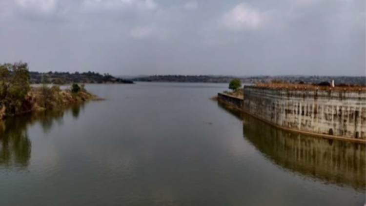
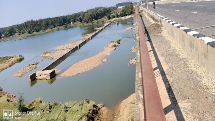
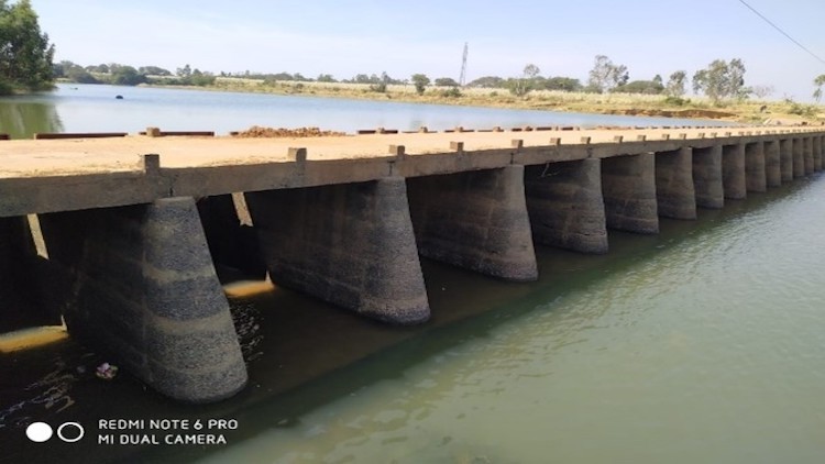
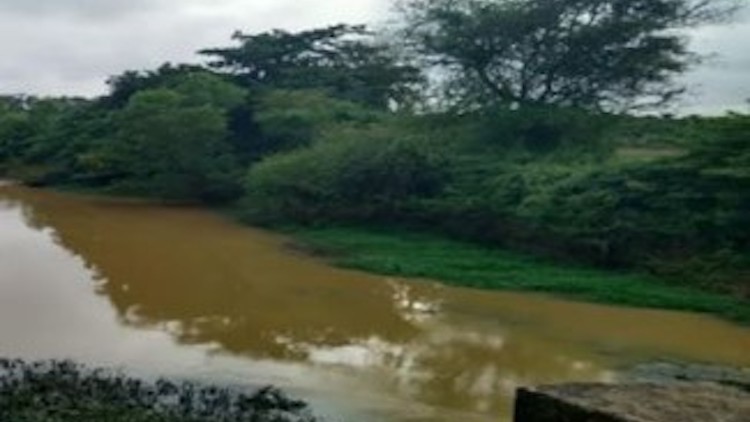
The Varada River originates near Vardamoola in Sagara, Karnataka. It flows through the Western Ghats and enters the central districts of Karnataka (Haveri and Bellary). The river joins the Tungabhadra River at Galaganath. Dandavati is a river that flows through Sorab, India. It originates from a reservoir in Kattinakere. The Kattinakere reservoir’s overflow canal turns into a creek gathering strength on its way to become the river Dandavati. The river flows via Kuppe and joins the Varada River at a place called Bankasana near Anavatti. Varada, in turn, joins Tungabhadra and later Krishna River which finally joins the Bay of Bengal in the East coast of India.
Minor Irrigation and Ground Water Development Division, Mangaluru, has invited tender for construction of 17 vented dams across various streams/Rivers in Bantwal Constituency. The important rivers across where construction of vented dams proposed are in Nethravathi River, Phalguni River, Guduri River, Virakhamba Nala etc. The proposal of these dams serves the purpose of storage and connectivity between two villages. All the above 17 locations are around BC road/ Nethravathi river. The villagers have suggested the dam location and have been recommended by MI officials and vented dams are proposed at these locations.
Construction of these vented dams serves the purpose of both storage and connectivity between the two villages. Construction of these dams will servers the purpose of storage for irrigation purposes and serves the connectivity between two places.