
Check Dams At Byrapura And Alavandi
Consultancy services for the preparation of Detailed project report for construction of two series of check dam across Hirehalla near Bhairapura village (check dam-1 & check dam 2) and check dam-3 across Kab halla near Betageri village at Koppal taluk, Koppal District’
Client:
M/s Karnataka Neeravari Nigam Ltd
Project Description:
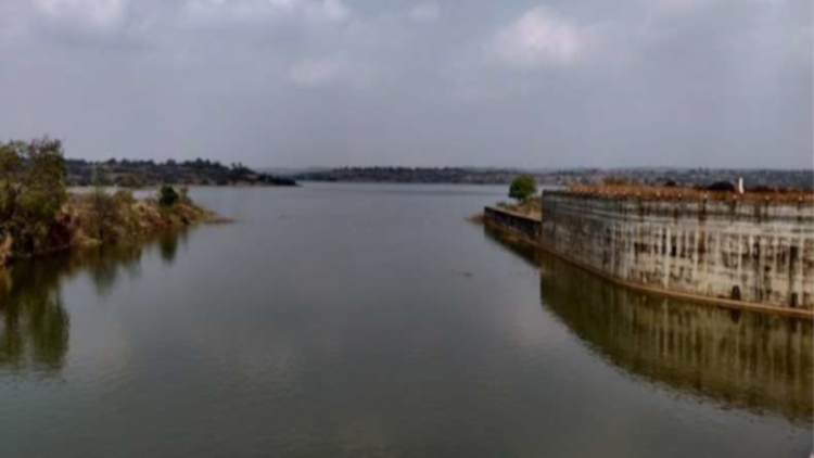
The Check dam -1 location is across Hirehalla which is situated near Bhairapura village which is just D/s of confluence point of Urumantina halla and Hirehalla. Geographical location of the Check dam is longitude Latitude: 15°12’7.75″N and Longitude: 75°59’9.18″E.
The check Dam will help in ground water recharge surrounding farmers can lift the water and can use it for irrigation and useful for cattle drinking purposes. Accordingly, the check Dam will envisage the storing of water for the proposed area in Koppal taluk.
The storage of Water due to construction of dam is 0. 41Mcft.Lengh of check Dam 85.0 m and catchment area is 369.393 km2. The Check Dam which is of solid concrete weir with top width of 1.0 m and 1.50 m depth of storage.
The cost of the Check Dam works out to be Rs 350.00 Lakhs
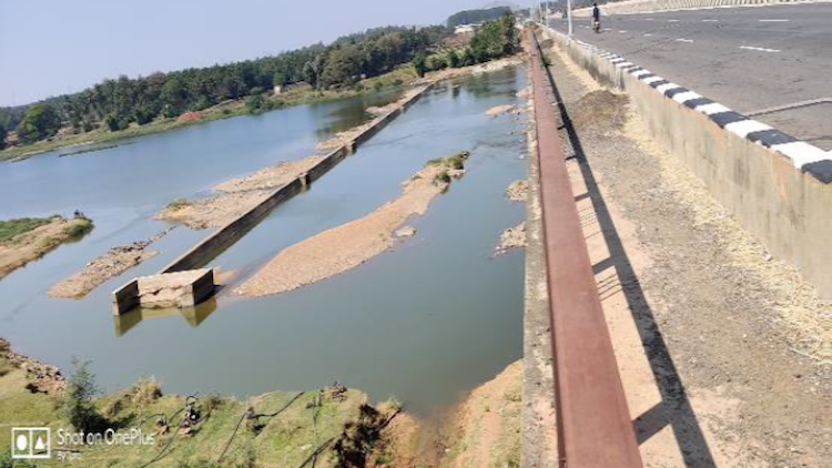
Check Dam-2
The Check dam -2 location is across Hirehalla which is situated near Bhairapura village which is just D/s of confluence point of Urumantina halla and Hirehalla. Geographical location of the Check dam is longitude Latitude: 15°12’46.49″N and Longitude: 75°59’5.13″E.
It is proposed to store the water in monsoon season and will be used for ground water recharge, cattle drinking and agricultural purpose.
The storage of Water due to construction of dam is 0. 17Mcft.Lengh of check Dam 65.0 m and catchment area is 193.022 km2. The Check Dam which is of solid concrete weir with top width of 1.5 m and 1.50 m depth of storage.
The cost of the Check Dam works out to be Rs 350.00 Lakhs.
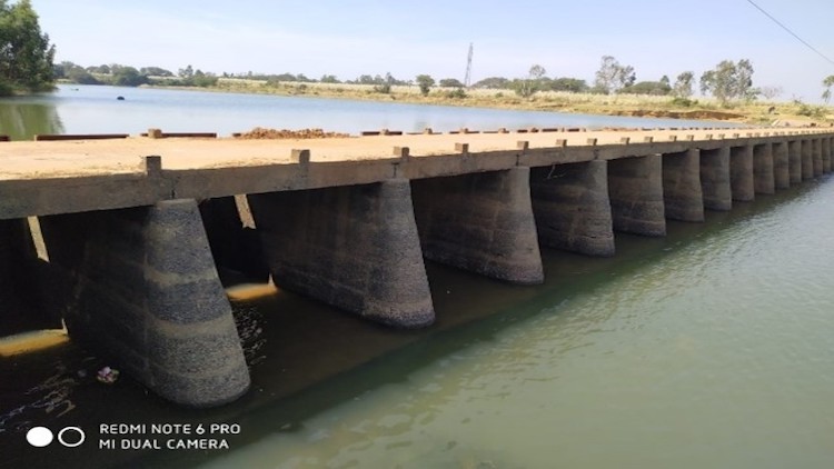
Check Dam-3
The Check dam -3 location is across across Kab Halla which is situated near Betageri. The check dam site is selected just U/s of Tungabhadra Reservoir. Geographical location of the Check dam is longitude Latitude: 15°13’52.29″N. and Longitude: 76° 3’43.70″E.
It is proposed to store the water in monsoon season and will be used for ground water recharge, cattle drinking.
and agricultural purposes.
The storage of Water due to construction of dam is 0. 11Mcft.Lengh of check Dam 50.0 m and catchment area is 30.558 km2. The Check Dam which is of solid concrete weir with top width of 1.5 m and 1.50 m depth of storage.
The cost of the Check Dam works out to be Rs 300.00 Lakhs.