Consultancy Services for survey, investigation, excavation of trial pit, drilling of trial core bores including Detailed Engineering, Preparation of Designs, C-Plans, Drawings, Estimates, Draft Tender Documents including preparation of necessary land acquisition proposals for Piped Distribution Network for 16,000 Ha for Kerur LIS in Badami taluka, Bagalkot District under Upper Krishna Project
Client:
M/s Krishna Bhagya Jala Nigam Ltd
Project Description:
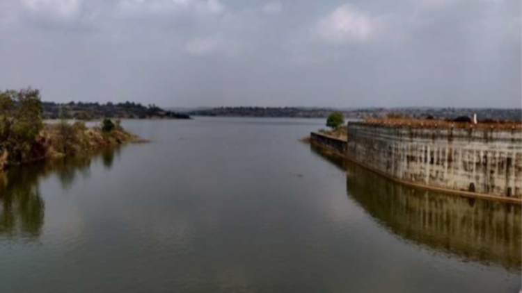
Badami taluka of Bagalkot district is an economically backward area comprising of about 70 to 80% of local population with agriculture as their main source of occupation. The annual rainfall in this region is very much lower in comparison to the state average and hence these farmers are growing only dry crops being water scare area. There is always a risk of possible crop failures or reduced yields due to uncertain and scanty rains. The topographical features coming under these areas, it is proposed to lift water from Ghataprabha River.
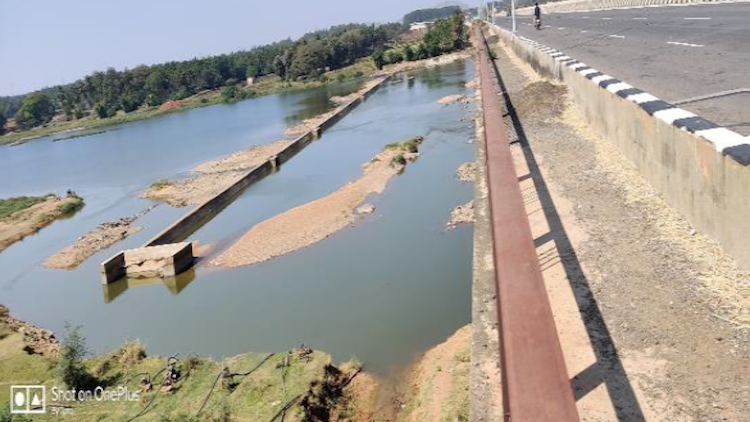
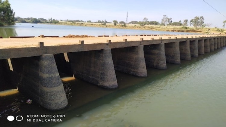
The proposed construction of Kerur (Herkal South) Lift Irrigation Scheme from Ghataprabha river near Anadinni village of Bagalkot district was prepared. The scheme is proposed for irrigating additional available area between Ghataprabha Right Bank canal (GRBC) of Ghataprabha project and Malaprabha Left bank canal (MLBC) of Malaprabha project. The proposed Villages of Badami taluka are situated on the right bank of Ghatapabha RBC and Left bank of malaprabha LBC. About 38500 Ha of land is situated between MLBC & GRBC and is deprived of irrigation. Out of this, the Herakal south LIS 6000 Ha and Herkal south LIS Extension 6100 ha is approved for Irrigation (Total- 12100 ha) from KBJNL Under UKP Stage-III.
There is demand from farmers and representation from Shri. Siddaramayya, Hon’ble leader of opposition in Karnataka Legislative Assembly and MLA of Badami assembly constituency vide his letter no: WRD/YS/221 dated: 11/7/18 had represented to provide irrigation facility to un-served areas in Badami taluka covering 39 villages namely Radder timmapur, Niralkeri, Haligeri, Tappasakatti, Kallapur, Halageri, Ugalwat, Mustigeri, karadigudda, muttalageri, Aladakatti (11villages) and other 28 villages.
After investigation it is found that 38 villages, Radder timmapur,Haligeri,and Niralakeri villages are partially covered in Herakal South Extension LIS. Excluding this already covered area Kerur LIS is planned for providing irrigation facility to un-served area of 16,000 Ha (ICA) in Badami taluka by lifting water from Ghataprabha River to highest point near Kerur town up to RL670.00m.
The scheme consists of preparation of C-planning, design and estimate of Gravity and pressure distribution.
network for 16000 HA command area and provision of SCADA operation.