Consultancy services for the preparation of DPR for construction of three series barrage across Vedhaganga river (Near Kunnur Sangam, Hunnaragi and Yamagarni) in Nippani Taluka, Belagavi District
Client:
M/s Karnataka Neeravari Nigam Ltd
Project Description:
Krishna River originates in the Mahadev Range of Western Ghats at EL 1338.00m above M.S.L in Maharashtra. It enters Karnataka at its 304th km and passes through the state for a length of 480 km and finally joins Bay of Bengal near Bapatla in Andhra Pradesh. The overall basin area is 2.57 lakhs sq.km and the basin area in Karnataka is 1.13 lakhs sq.km.
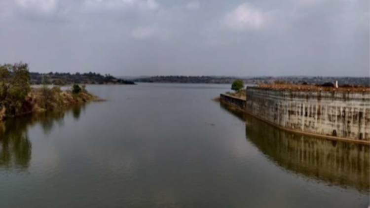
The Vedhganga river joins the Dudhganga river which further joins the Krishna River as Panchaganga river. Several villages like Jatrat, Barawad, Kunnur in Karnataka are dependent on River Vedhganga for water. The Vedhganga river rises at an elevation of 900 m in the Kolhapur District of Maharashtra State from the eastern slopes of the Western Ghats. The river flows mostly northeastwards in Maharashtra State and thereafter continues to flow eastwards in Karnataka state to join the Dudhganga river at Barawad in Karnataka, Dudhganga river flowing eastwards joining the Krishna River in Nippani Yedur in Karnataka from the right bank.
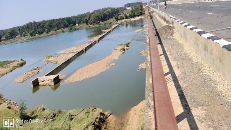
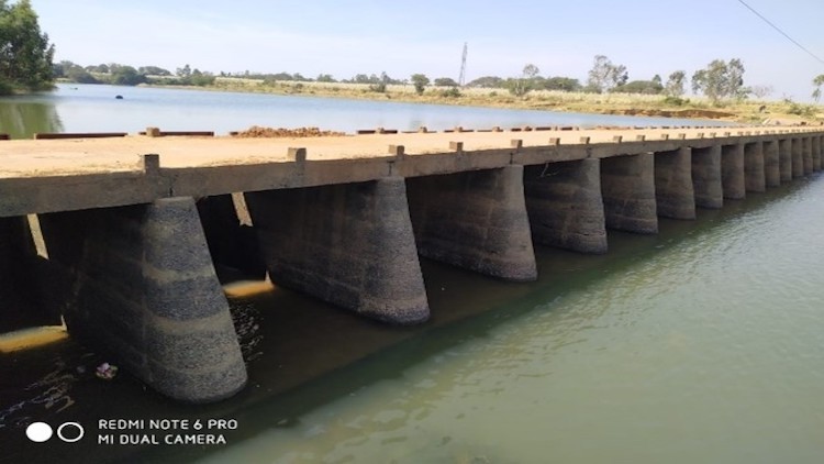
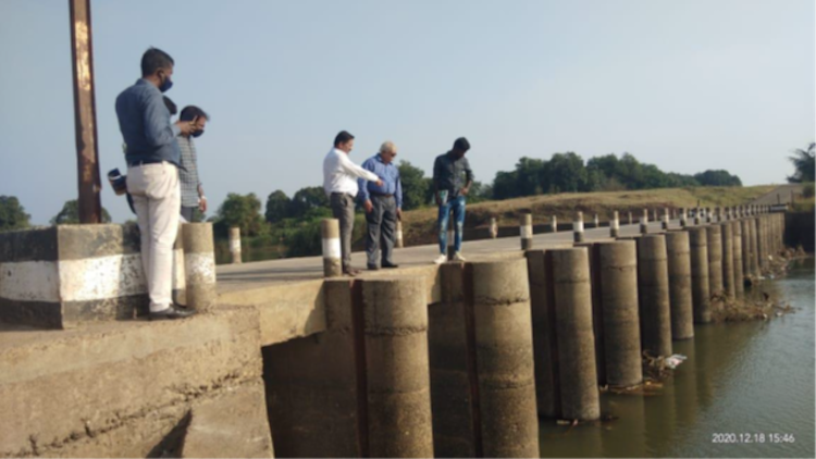
Three Bridge cum Barrages are proposed across Vedaganga River Near village Kunnur, Hunnargi and Yamagarni village. The Bridge cum Barrage near Kunnur sangam Village and Hunnargi villages are newly proposed barrages to create storage for drinking water purpose. And near village Yamagarni there is existing check dam on U/S of NH-04 Bridge. The storage is not sufficient for drinking water and Tank filling Scheme as there is newly proposed tank filling scheme. To increase the storage capacity, Bridge cum Barrage is proposed by dismantling existing check dam. Length- 54 m