
Yadagoppa Lift Irrigation Scheme
Consultancy services for detailed investigation, survey, preparation of designs, drawings, estimates, Detailed Project Report and DTP for Yadagoppa tank filling scheme by lifting water from Dandavathi river in Soraba taluk, Shivamogga District. (INDENT No33491)
Client:
M/s Karnataka Neeravari Nigam Ltd
Project Description:
Shivamogga district is a part of the malnad region of Karnataka and is also known as the “Gateway to Malnad” or “Malae naada Hebbagilu”. The district is landlocked and bounded by districts of Haveri, Davangere, Chikkamagaluru, Udupi and Uttara Kannada. The district lies between 13°55’20” North latitude and 75°34’14.73″ East longitude in south Karnataka at mean altitude of 640 mtrs above sea level, Total geographical area of the district is 8477 Sq Kms spread across 7 talukas -Thirthahalli 1254 Sq kms), Bhadravathi (690 Sq kms), Shivamogga (1113 Sq kms ), Shikaripura(909 Sqkms ), Soraba (1148Sq kms ), Sagara (1940 Sq kms), Hosanagara ( 1423 Sq kms) -which is 3.1% of the state geographical area. Of which 6641 Sq km falls under Western Ghat region (Sagar1940 sq km, Hosanagara 1423 sq km, Thirthahalli 1254 sq km, Shikaripura 909 sq kms, Shivamogga 1113 sq kms. The total average rainfall of 7 talukus is -2237.00 mm. Shikaripura and Shivamogga taluks comes under Southern transition zone.
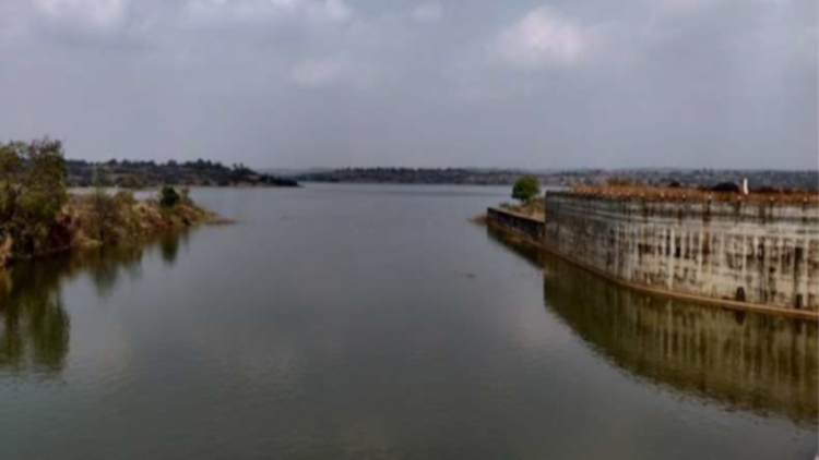
The important rivers that flow through the Shivamogga district are Tunga, Bhadra, Tungabhadra, Sharavati, Kumudvati and Varada. The Tunga and the Bhadra unite to form the Tunga-bhadra at Kudali in Shivamogga taluk, 14 kms From Shivamogga. The Kumadvati and the Varada are tributaries of the Tungabhadra. Kumadvati River is east flowing river, and it is one of the tributaries of Thungabhadra. The river originates at Kumbha Thirtha in Shivagange hills and flows for 45 km before its confluence with the Arkavathi river at Thippagondanahalli (T.G.Halli) reservoir. The river basin is spread across 460 Sq. Km and the entire catchment area encompasses 278 villages.
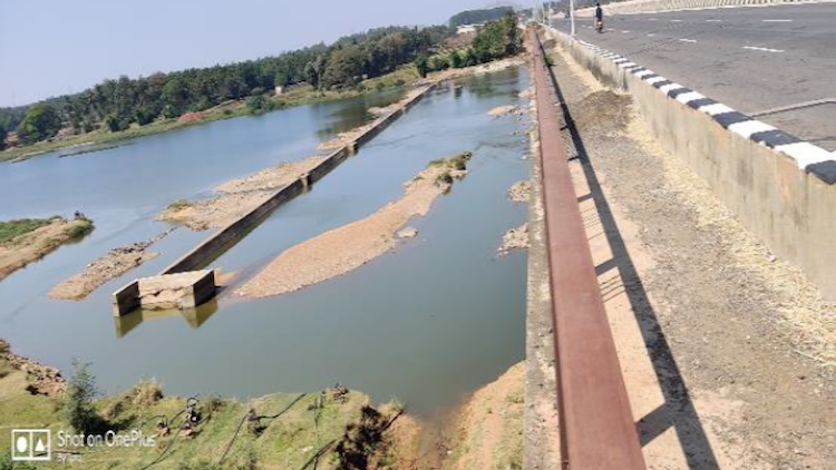
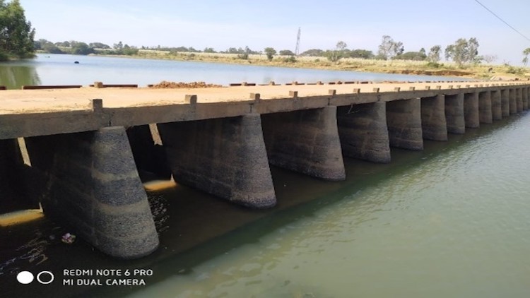
Due to scanty rainfall in the catchment area in the past years and, also due to development activities in the upstream catchment the tanks are not receiving the desired quantum of water. The villagers are mainly dependent on these tanks for drinking water and other purposes.
In view of above requirements, it is proposed to take up the scheme for filling up of 12 tanks by lifting water from Dandavathi River in Soraba Taluka of Shivamogga District.
Government of Karnataka has considered the demand and initiated studies for mitigating the problem faced by the people. A preliminary study is undertaken by KNNL for addressing the same and found that Dandavathi River near in Soraba Taluka of Shivamogga District is the nearest sustainable surface source of water for filling these tanks.